Day Fourtynine
Day Fourtynine

Arches National Park, UT to Bryce Canyon National Park, UT
July 31st, 2004

High Point of the Day....
Low Point of the Day......
Brian - Driving on a fin
Theresa - Hiking in the hoodoos
Brian - None at all
Theresa - Driving on a fin
Miles Traveled Today
Total Miles Traveled
Miles Theresa Drove
Weather
332
11653
292 (3499 Total)
Cloudy with intermittent sun, in the 80's
Price of Gas 
(average per gallon)
Wildlife
Night's Lodging
Where this Page was Uploaded
2.05
Cows, lizards, and a wild turkey
Sunrise Campground
Sedona, AZ

Daily Didactic
Another ridiculously scenic day in southern Utah. We started the day unusually early for us in the summer months, with two things in mind. First, was getting to Bryce Canyon National Park before it was the forecasted high of 105 degrees out. Second, was getting to Bryce on a summer Saturday before the campground was full. So we rose at 6:00ish and headed north out of Arches to a short chunk of I-70 that carried us west to Utah Highway 24 south to Hanksville. From Hanksville, we followed Highway 24 through Capital Reef National Park until we reached the small town of Torrey, where we hung a south on Highway 12 which crossed through Grand Staircase-Escalante National Monument and eventually lead us to Bryce. These roads turned out to be much windier and hillier than we had expected, and the drive through Escalante had one very exciting section that ran out to the end of a large rock fin and then took a 14% grade drop off the end. It was even more exciting because Theresa was driving and she loves narrow, steep windy roads very much. All of this took much longer than had envisioned and our projected 12:00 noon arrival at Bryce turned into 1:30. Fortunately, it seems to be a slow summer in our nation's national parks and we got one of a few campground remaining sites. We hit the quaint old lodge for a little lunch and then headed the 14 miles out to the end of the park road.

Bryce's specialty is hoodoos. Turns out a hoodoo is the tail end of an erosion cycle for a rock fin, after the point that an arch has formed and collapsed in between two rock spires. This leaves a lot of needle like columns around, in Bryce they call them sentinels. Bryce has a rim drive with a series of pull outs that lets folks ogle at the hoodoos, an incorrectly named arch, and a beautiful expanse of plateaus to the south and east. The rock formations, combined with their redish and pinkish colors, are really just amazing to look see. There is also a trail below the rim that we will be back to do when we have more time and it is not so hot. Although, with regard to heat, we appear to have lucked out today. With a mostly overcast sky, it didn't hit 90 in the park.

After the auto tour, we hit the Visitor Center, and then headed on up the road to Fairyland Point. Fairyland Point not only offers an up close and personal hoodoo opportunity, it sports a trail that Theresa had her mind on. We hiked a small section of the trail and doubled back, enjoying a "non rim" look at the formations. We headed back to camp, dumped the 204 pictures we took today into the computer, and had some spaghetti before calling it a very awesome "Four National Park/Monument Day".


Daily Pictures (Slide Show)

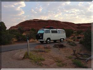
Morning in Devil's Garden campground 
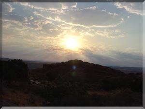
The morning sun breaks through, over some folks we don't know
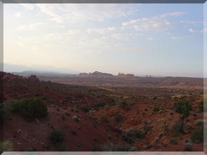
A hazy view from Devil's Garden toward Balanced Rock 
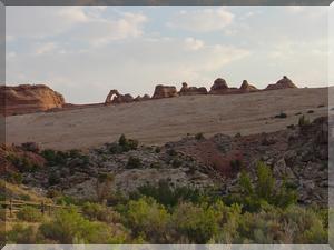
Delicate Arch on the left, from a distance
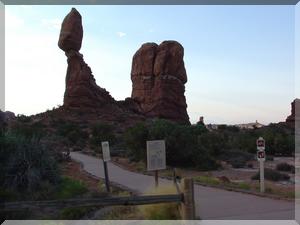
Balanced Rock 
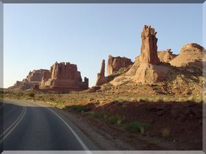
The drive out of Arches National Park, toward Park Avenue
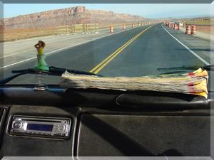
It's becoming a pretty well used road atlas 
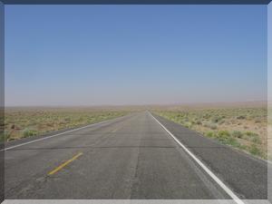
The smoky haze on the road toward Hanksville
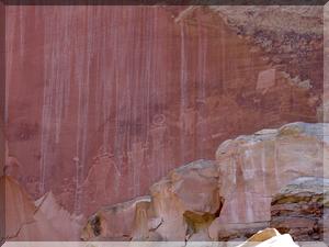
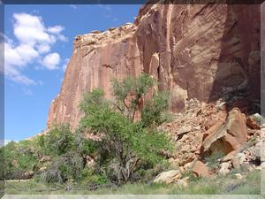
High cliff in Capital Reef National Park... ...sporting petroglyphs
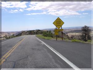
Another awesome stretch of road. This one runs down the top of a rock fin, and then off of the edge, in Escalante National Monument. 
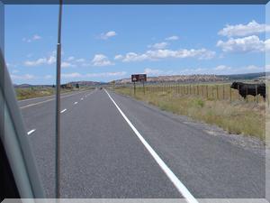
A cow points the way to...
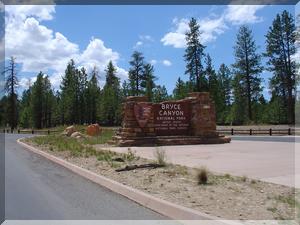
...the Bryce National Park Entrance 
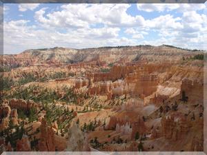
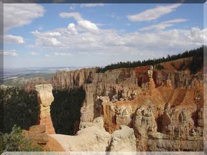
Looking down from Sunset Point, into the Bryce Amphitheater
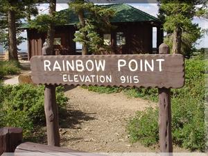
End of the road, Rainbow point lookout 
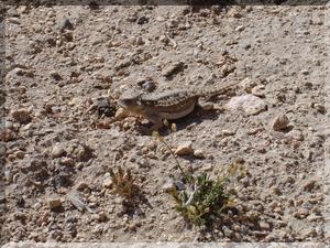
The very cute Mountain Short-Horned Lizard
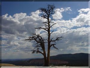
Cool tree at the edge of Yovimpa Point View at Agua Point overlook
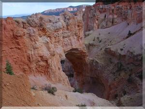
The incorrectly named Natural Bridge, actually an arch 
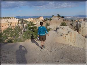
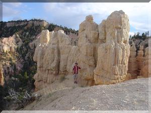
Theresa leading the way into the hoodoos, on the Fairlyland Point trail
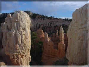
Turns out this is a hoodoo Lotsa hoodoos


Road Trip YesterdayRoad Trip HomeRoad Trip Tomorrow